


SNOW?! Why yes, we could see snow in Colorado over the next few days!
A high-impact winter storm system is set to hit western and central Colorado from Wednesday afternoon through Friday.
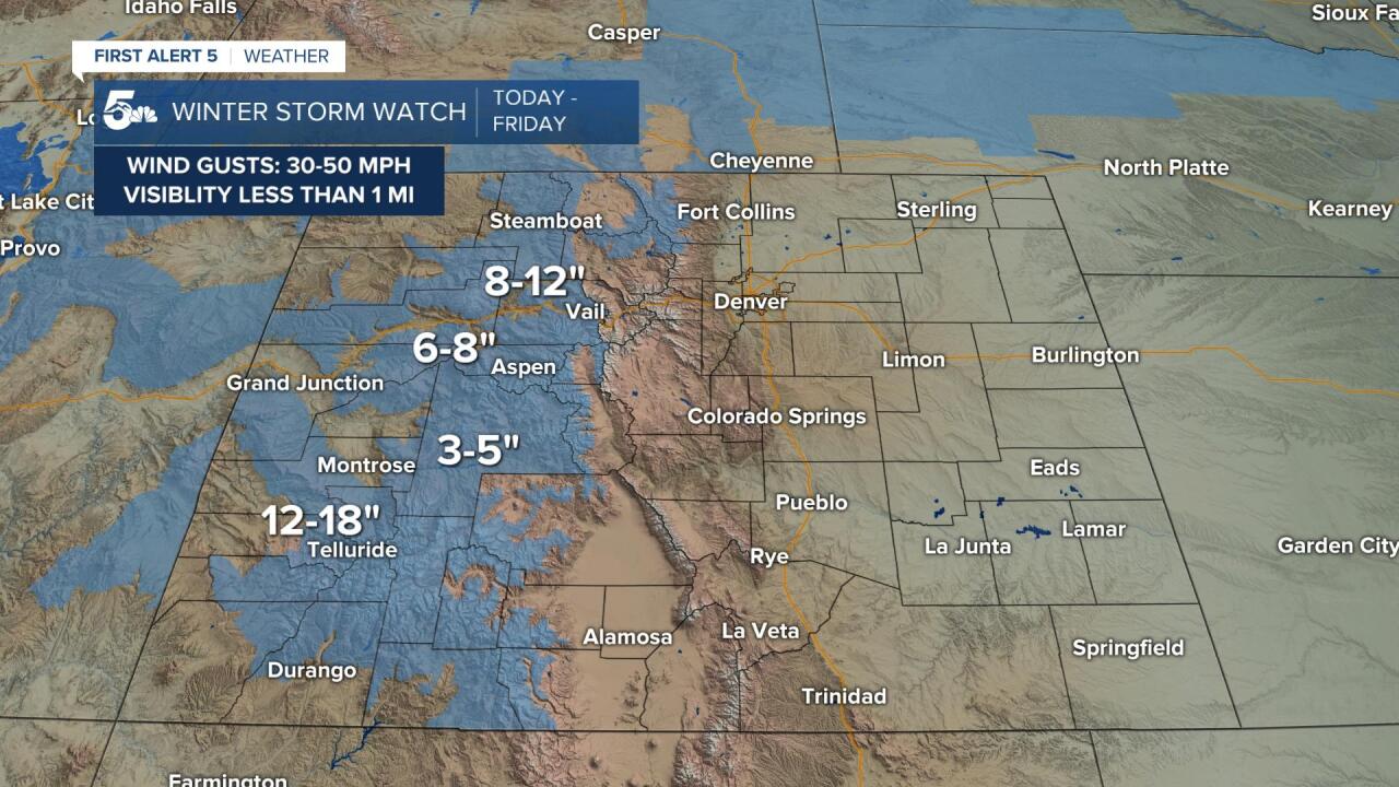
The National Weather Service has issued a Winter Storm Watch from the San Juans up through the central mountains from Wednesday afternoon through Friday.
Within the areas under this watch, moderate to heavy snow is expected with low visibility and strong wind gusts. Wind chills could be down into the 20s if not lower, especially at night.
Here's our latest forecast snowfall amounts for Colorado. Biggest accumulations in the mountains, and we still look to be on track to finally end that snowless streak at DIA. Not a drought buster but beneficial nonetheless. #COwx pic.twitter.com/6LHOpyjasv
— NWS Boulder (@NWSBoulder) December 8, 2021
Travel could be difficult, if not impossible, over the Continental Divide, especially Thursday night through Friday morning when heavier snow is forecast to fall.

This couldn't come at a better time, as our statewide snowpack is well below average.
Most areas in the west and central mountains are anywhere between 50 to 75 percent below the average snowpack for this time of year.
A low early season snowpack can have damaging impacts for the following Spring and Summer.
Less runoff from snowmelt means less water in reservoirs, rivers, and streams.
If we can't get more snow up in the mountains over the next few months, fire season could be more extreme in the summer and fall of 2022.

Snow over the mountains will fall in two parts.
The first round of snow will fall Wednesday afternoon through Thursday morning. This will be the lighter round with light accumulations along I-70.
The heavier round will fall Thursday afternoon through Friday morning.
This is where travel could be extra dangerous from heavy snow, visibility near 0 miles, and wind gusts over 30 mph.
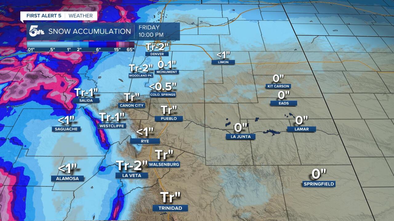
Locally... this system has the trappings of a bust.
The system moved north by about 1 to 200 miles from when we were forecast on Monday, and that would lead to a dry and winy pattern across southern Colorado.
If we do see light accumulations, it'll be most likely from the Pikes Peak Region up to Denver, and out west into the mountains and valleys.
As far as timing in southern Colorado, snow probably falls and accumulates after the morning commute and through the early afternoon.
We'll update the forecast as more data comes in, but no one should be hoping for much snow if the current storm track holds.
