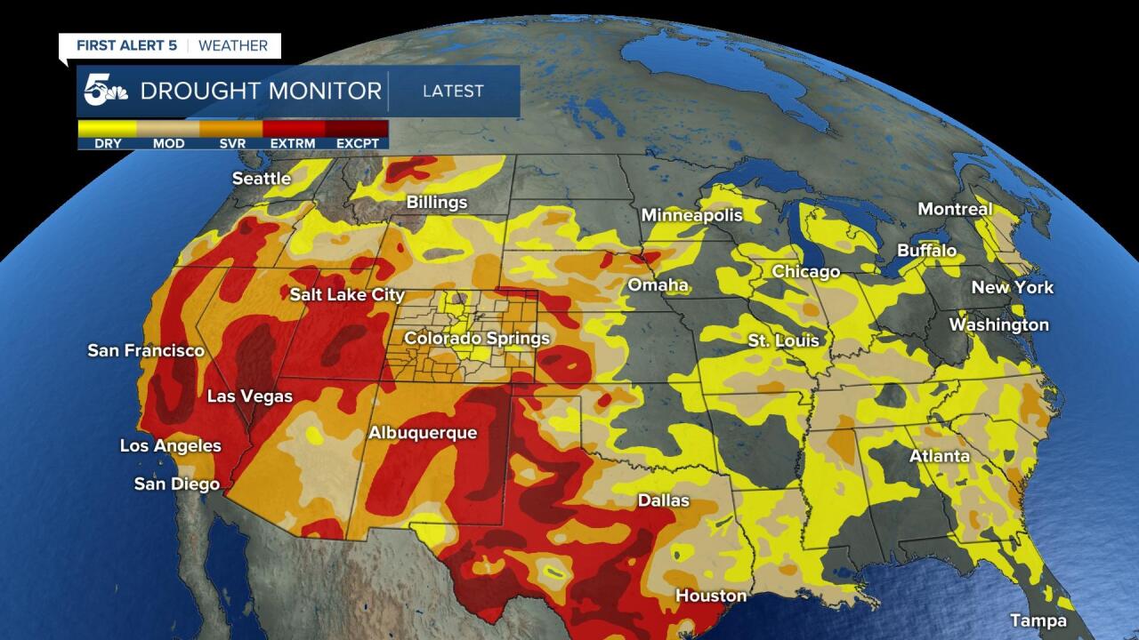
An earlier than normal monsoon season has brought benefical rain to Colorado for over the last few weeks!
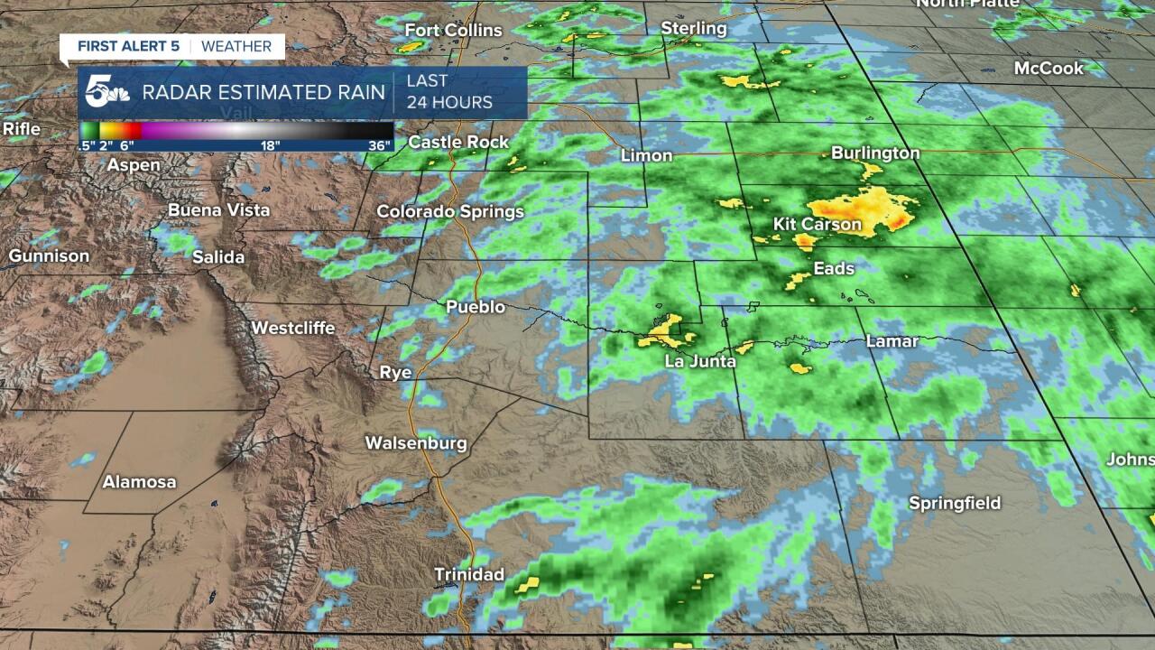
On Wednesday, strong and severe thunderstorms charged off the mountains and drove east into Kansas through the evening.
Areas in darker green are radar estimated rain totals of 1 to 1.25 inches, while the yellows are 2 or more inches!
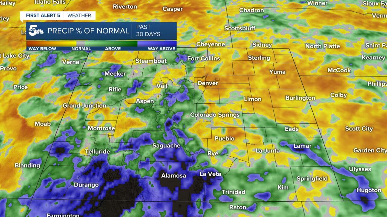
Over the last 30 days, the southern half of Colorado has seen a tremendous amount of rain. The areas in purple show way more rain than normal, while the areas in dark orange are way below normal.
Monsoon driven thunderstorms have provided excess rain to the Sangre De Cristos and San Luis Valley, but especially the San Juan and La Garita Mountains.
While we've seen rain up in the Pikes Peak Region, Pueblo, and Denver area, we're still below normal for this time of year.
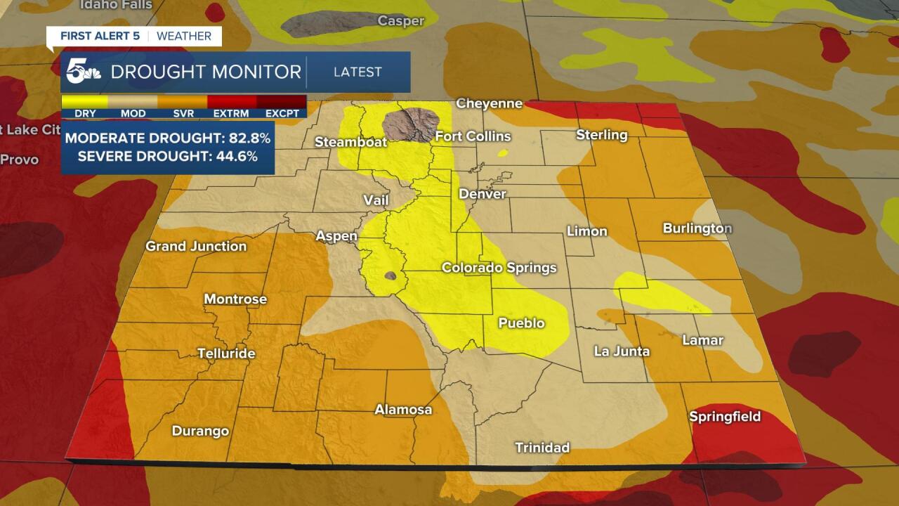
Early monsoon moisture has led to signs of progress across Central Colorado, and a huge uptick in drought relief across the southern half of the state.
Along the Front Range, down into Fremont, Custer, and even Pueblo County, abnormally dry conditions continue to spread. Abnormally dry is the lowest criteria of the drought monitor.
Baca County, which includes Springfield in far SE Colorado, has seen a slight improvement, but remains the most drought-affected county in the state.
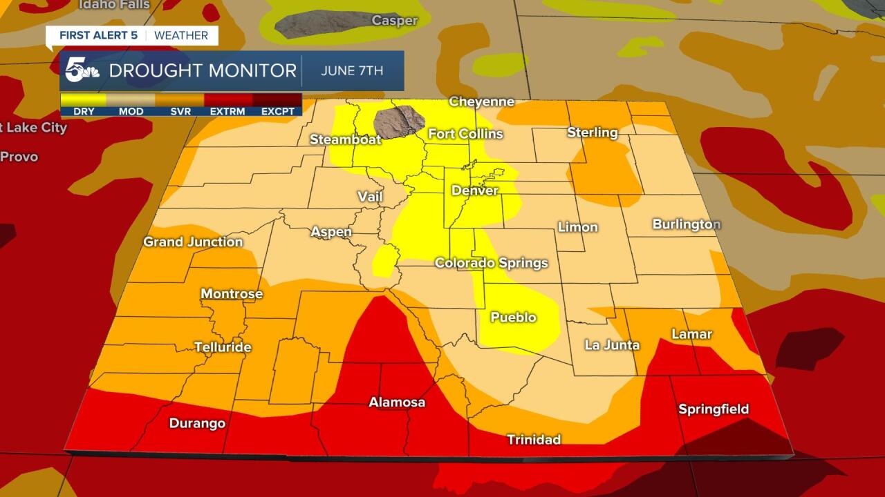
When we look back at the start of June, extreme drought was much more extensive.
All of the San Luis Valley, much of the San Juans, and all of Baca County was consumed by extreme drought.
We still have a long way to go, but there are signs of hope through August.
July is usually the wettest month of the year for our state, so as long as we keep driving more monsoon moisture into the state, we should keep chiseling away at the current drought.


