


Heavy snow over the high country this week has lead to extremely high avalanche danger through the central and northern zones of the Rockies.
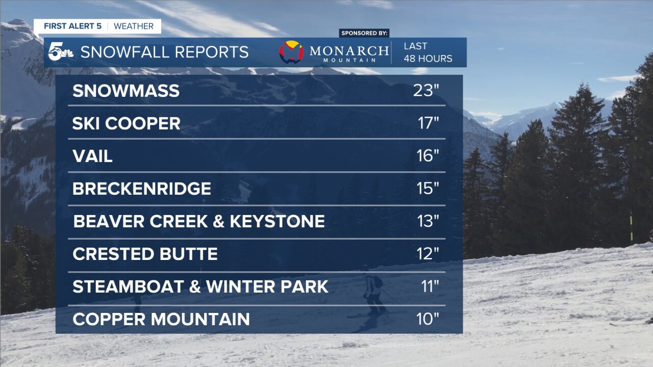
From Thursday into Friday, Aspen Snowmass received nearly 2 feet of snow, while Crested Butte, Beaver Creek, Keystone, and Breckenridge all came in right around a foot.
This dump of heavy snow, with more on the way today, has pushed avalanche danger into the 4 out of 5 "high" rating by the Colorado Avalanche Information Center.

The zones in the most danger today and tomorrow are the Steamboat & Flat Tops, Vail & Summit Counties, Aspen, Gunnison, and the Sawatch range.
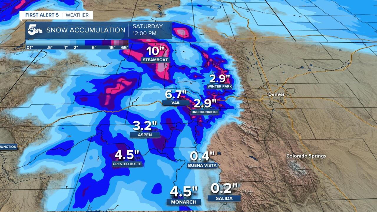
Several more inches of snow are expected to impact these areas today, along with daytime temperatures in the teens and wind gusts in the 30 to 50 mph range.
Out of bounds skiing is not advised and considered extremely dangerous through the weekend.
Driving conditions on I-70 and Highway 24 will be very poor tonight through Saturday, so leave extra early and communicate well before you take off.
