


Have you noticed how cold and cloudy it's been lately? On top of that, we had snow Tuesday night with more on the way Thursday night!
This weird April weather all stems from a unique weather pattern called an Omega Block.

An Omega Block is an upper-level atmospheric pattern with two areas of lower pressure on either side of a warmer, high-pressure area.
It gets its name by resembling the letter Omega in the Greek Alphabet.
Cool and wetter weather tends to occur on the sides of an Omega Block, with warmer and drier weather near the middle.

The Omega Blocking pattern that has developed this week is situated pretty far south and is quite elongated.
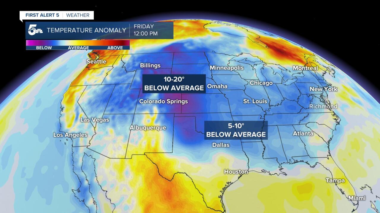
The dip south has allowed for temperatures to stay below average all week, and we could get even colder by Friday!
The slow-moving low pressure area to our west is providing lift near Colorado, shooting pieces of energy over the state, and pulling moist upslope winds across the state.

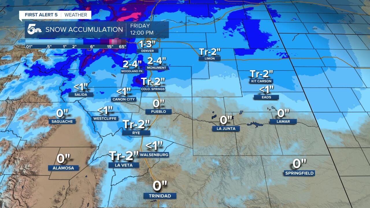
This pattern resulted in light snow across the mountains and Pikes Peak Region Tuesday night, with even more rain and snow chances expected through the weekend!
One interesting thing about this omega pattern is that the flatter high-pressure ridge in the middle will still allow for rain and thunderstorms in Texas and along the Gulf Coast.
As far as our moisture is concerned, we could see spotty showers over the mountains today with a mix of light snow to showers in the plains tonight.
The next big chance for snow arrives Thursday night through early Friday morning. The heaviest snow will fall over the Pikes Peak Region, but we could see a scattered inch or two outside of the Wet Mountain Valley.
